


AutoScene Draw for DNR & Conservation
Scene Diagramming Built for Conservation Officers and Game Wardens
Whether you're documenting a boating accident on a remote lake, mapping a poaching incident deep in the backcountry, or planning a prescribed burn across thousands of acres, AutoScene Draw (ASD) helps you build accurate, to-scale diagrams in seconds. So you can get back to protecting the land and water you serve.
You Didn't Become a Conservation Officer to Fight With Software
You're covering thousands of square miles of wilderness, lakes, and public land; often alone, often without reliable cell service. When an incident happens, the last thing you need is a diagramming tool that was designed for a desk job.
Right now, too many DNR and Conservation officers are stuck with one of two options: hand-drawn sketches that don't hold up in court, or overly complex software that takes longer to learn than it does to actually process the scene. Either way, you're spending your time on paperwork instead of patrols.
That's not good enough. Your work matters, and your tools should keep up.
What ASD Does: One Click. Your Entire Scene is Drawn to Scale.
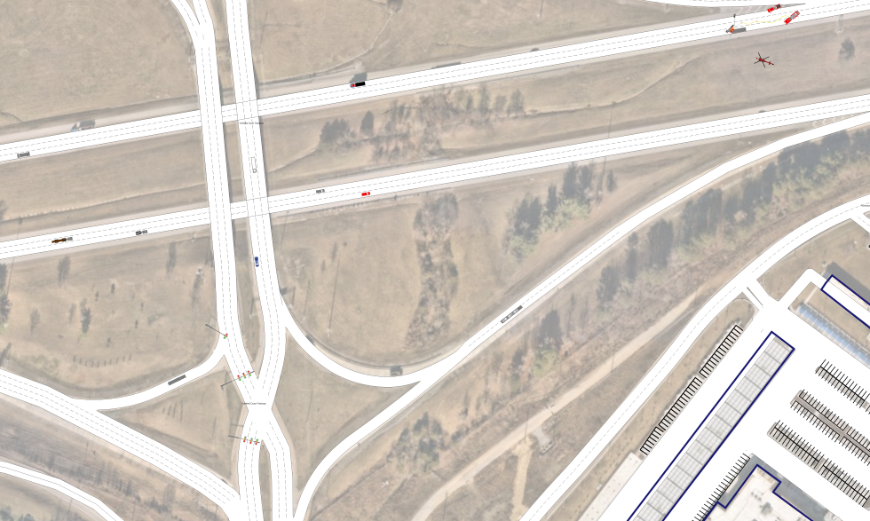
AutoScene Draw (ASD) is a fast, easy-to-use diagramming platform built for public safety professionals, including conservation officers, game wardens, and DNR field staff. Just enter a location, and ASD auto-generates accurate, to-scale roads, trails, waterways, intersections, and building layouts using geolocation data.
No manual drawing. No wasted hours. You just get a professional, court-ready diagram in under 30 seconds.
Built for Every Scene a Conservation Officer Handles
ASD isn't a one-trick tool. Here's how DNR agencies are putting it to work across the full range of their operations:
Boating & Watercraft Accident Documentation
Diagram boat crashes, PWC collisions, and dock incidents on lakes and rivers with geolocation-based accuracy.
Poaching & Wildlife Crime Scene Mapping
Document poaching sites, illegal kill locations, and evidence placement quickly, even in remote terrain.
Wildfire & Prescribed Burn Planning
Map burn perimeters, staging areas, escape routes, and crew positions across large areas. Go from planning to execution with a visual that your whole team can follow.
Timber Theft & Habitat Destruction
Capture the scope of illegal logging, habitat damage, or unauthorized land clearing with accurate, scaled diagrams tied to real-world geography.
Search & Rescue Operation Mapping
Lay out search grids, staging areas, helicopter LZs, and team assignments on a to-scale map. ASD is fast enough to keep up with a developing SAR situation.
ATV & Snowmobile Accident Scenes
Document off-road vehicle crashes on trails, service roads, and unimproved terrain with the same precision you'd expect from a highway crash tool.
Illegal Dumping & Environmental Crime
Map the location and extent of illegal waste sites, contamination boundaries, and evidence for environmental enforcement cases.
Event & Facility Planning
Plan managed hunts, fishing tournaments, outdoor festivals, and campground operations with detailed, to-scale facility layouts.
Why DNR Agencies Are Choosing AutoScene Draw
Diagram Any Scene in Under 30 Seconds
Enter a geolocation and ASD auto-generates roads, trails, and structures instantly. What used to take hours now takes seconds.
Works Where You Work, Even Off-Grid
Designed for officers who operate in remote areas, not just at a desk. Use it on a laptop or tablet wherever the job takes you.
Court-Ready from the Start
Every diagram is to-scale and standardized, so your documentation stands up under cross-examination without extra prep.
Drag-and-Drop Simplicity
Add vehicles, boats, evidence markers, people, structures, terrain features, and more from a library of ready-made symbols.
3D Scan Integration with Dot3D
Pair ASD with Dot3D Pro to turn 3D video scans of any scene into detailed, accurate 2D diagrams, layered right on top of satellite imagery.
Integrates with Your Reporting Systems
ASD is built to work with over 60 reporting systems, so your finished diagrams go directly into your existing workflow.
Satellite Imagery Overlay
Auto-align your diagrams to real-world satellite imagery for instant geographic context, critical for wilderness and waterway scenes.
One Platform for Your Entire Agency
ASD handles everything from a boating crash to a prescribed burn plan to a courtroom exhibit, all in one place.
How it Works: From Scene to Screen in Three Steps
Step 1: Enter Your Location
Type in an address, coordinates, or drop a pin. ASD pulls geolocation data and builds your base map (roads, trails, structures) automatically.
Step 2: Add Your Details
Drag and drop symbols for vehicles, boats, evidence, people, boundaries, and more. Add measurements, labels, notes, and photos.
Step 3: Submit and Move On
Save your finished diagram directly into your reporting system or export it for court. Done. Back on patrol.
Trusted by Agencies Across the Country
AutoScene Draw is built by SmartSafety Software, the team behind Easy Street Draw and ScenePD. Our tools have been trusted by thousands of law enforcement and public safety agencies for over two decades.
ASD is already in use by police departments, sheriff's offices, state agencies, tactical teams, and logistics operations nationwide.