


AutoScene Draw for Insurance Professionals
Accurate Scene Diagrams for Insurance Adjusters — Built in Minutes
Whether you're documenting a multi-vehicle collision at a busy intersection, mapping property damage after a storm, or building an exhibit for a subrogation case, AutoScene Draw (ASD) helps you create precise, to-scale diagrams faster than any tool you've used before. Spend less time on documentation and more time closing claims.
Your Claims Are Piling Up. Your Diagramming Tools Shouldn't Slow You Down.
You've got a stack of claims on your desk, field inspections to schedule, and carriers waiting for documentation. When it comes time to diagram the scene (whether it's a rear-end collision, a slip-and-fall in a parking lot, or hail damage across a commercial property), your options aren't great.
Hand-drawn sketches are fast, but they fall apart under scrutiny from opposing counsel. Generic drawing tools like PowerPoint take forever and don't produce anything to scale. And the estimating platforms you already use? Their sketch tools were built for floor plans and roof measurements, not collision reconstruction or multi-scene incident documentation.
You need a diagramming tool that's purpose-built for scene documentation. A tool that gives you professional, defensible results without eating up half your day.
What ASD Does: Professional, To-Scale Scene Diagrams
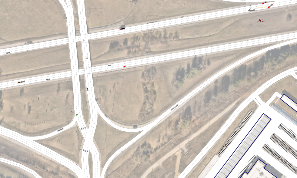
AutoScene Draw (ASD) is a fast, intuitive diagramming platform purpose-built for professionals who document scenes, including insurance adjusters, field investigators, SIU teams, and claims managers. Just enter a location, and ASD auto-generates accurate, to-scale roads, intersections, structures, and parking layouts using geolocation data.
You get a professional, defensible diagram that stands up in depositions, arbitration, and court. Also, you can build it on a laptop or tablet right at the scene.
Built for Every Scene an Insurance Professional Handles.
ASD isn't just another crash sketch tool. Here's how insurance adjusters and claims teams are putting it to work across the full range of their caseload:
Auto Collision & Crash Documentation
Diagram single-vehicle, multi-vehicle, and intersection collisions with geolocation-based accuracy. Automatically generate the exact road layout, then add vehicles, measurements, skid marks, debris fields, and traffic controls.
Property Damage Scene Mapping
Document the extent of structural damage, water intrusion paths, fallen trees, debris fields, and affected areas on an accurate, to-scale diagram. Perfect for storm damage, fire loss, and catastrophe claims.
SIU & Fraud Investigation Support
When a claim doesn't add up, your Special Investigations Unit needs clear, precise documentation. ASD lets SIU teams diagram reported incident scenes, identify inconsistencies, and build visual exhibits that support fraud determinations.
Subrogation & Litigation Exhibits
Create professional, to-scale courtroom exhibits for subrogation hearings, arbitration, and civil litigation. ASD diagrams are built on verifiable geolocation data.
Slip-and-Fall & Premises Liability
Map parking lots, sidewalks, entryways, stairwells, and commercial properties to document the exact conditions and layout at the time of a slip-and-fall or premises liability claim. Add measurements, lighting positions, and hazard markers.
Multi-Vehicle Pileup & Complex Scenes
When a scene involves five, ten, or twenty vehicles across multiple lanes and directions, hand sketching isn't an option. ASD auto-generates the road network and gives you the space and tools to accurately position every vehicle, barrier, and piece of evidence.
Workers' Compensation Incident Documentation
Diagram workplace injury scenes (construction sites, warehouses, loading docks, retail floors) with accurate layouts that document equipment positions, fall distances, and environmental conditions relevant to the claim.
Catastrophe (CAT) Response Documentation
When you're deployed to a CAT zone, you're handling dozens of claims across a large area. ASD helps you quickly produce consistent, to-scale diagrams, standardizing your documentation.
Why Insurance Professionals Are Choosing AutoScene Draw
Diagram Any Scene in Minutes
Enter a location and ASD auto-generates roads, intersections, structures, and parking lots instantly. What used to take an hour of manual sketching now takes minutes.
Geolocation-Based Accuracy
Every ASD diagram is built on GIS-sourced map data, giving your documentation a clear, verifiable origin. When opposing counsel asks how the diagram was created, you have a defensible answer.
Built for the Field, Not Just the Office
Use ASD on a laptop or tablet right at the scene. You can use ASD during a field inspection, at the loss site, or in a parking lot after a collision. No need to wait until you're back at your desk.
Drag-and-Drop Symbol Library
Add vehicles, pedestrians, traffic signals, road signs, barriers, evidence markers, property boundaries, structural elements, and more from a ready-made library. No design skills needed.
3D Scan Integration with Dot3D
Pair ASD with Dot3D Pro to turn 3D video scans of properties, collision scenes, or commercial spaces into detailed 2D diagrams layered on satellite imagery. It is perfect for complex or high-value claims.
Satellite Imagery Overlay
Auto-align your diagrams to real-world satellite imagery for instant geographic context. Critical for property claims, intersection collisions, and large-loss documentation.
Export-Ready for Any Workflow
Export your finished diagrams in multiple formats for attachment to claims files, carrier submissions, legal exhibits, or internal documentation systems.
One Tool for Your Entire Caseload
Stop using different tools for different claim types. ASD handles everything from a fender bender to a commercial property loss to a courtroom exhibit.
How ASD Compares to the Tools You're Currently Using
How it Works: From Incident to Diagram in Three Steps
Step 1: Enter Your Location
Type in an address, intersection, or GPS coordinates. ASD pulls geolocation data and builds your base map (roads, intersections, structures, parking areas) automatically.
Step 2: Add Your Details
Drag and drop vehicles, pedestrians, property boundaries, evidence markers, measurements, labels, and photos directly onto the diagram. Adjust anything manually to match exactly what you observed.
Step 3: Export and Attach
Save your finished diagram and export it for your claims file, carrier submission, legal exhibit, or internal records. Done. Move on to your next claim.
Trusted by Thousands of Public Safety & Insurance Professionals
AutoScene Draw is built by SmartSafety Software, the company behind Easy Street Draw and ScenePD. SmartSafety Software is the creator of products trusted by law enforcement, first responders, and insurance professionals for over two decades. Law enforcement, insurance adjusters, and first responders rely on SmartSafety products for their accuracy, customization, and ease of use.
Easy Street Draw and ScenePD are used in 77 countries and by more than 60% of U.S. law enforcement. Now, with AutoScene Draw, SmartSafety is bringing that same proven reliability and speed to the next generation of scene diagramming, and insurance professionals are taking notice.